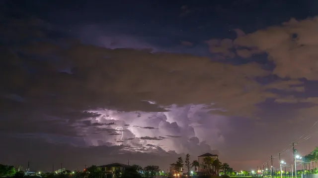
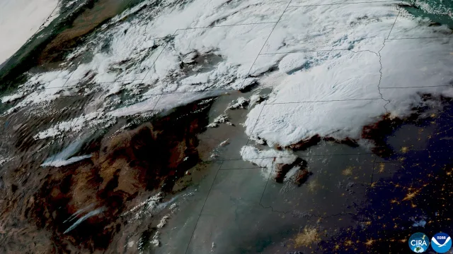
A sprawling autumn storm system triggered severe weather alerts across the central United States on Monday, Nov. 2, bringing risks of damaging wind gusts, heavy rain, and isolated tornadoes from Nebraska and Iowa southward into Kansas and Texas.
The turbulent weather is being pushed eastward by a cold front, according to regional forecasts. The Storm Prediction Center placed portions of the region, including the Kansas City metropolitan area, under a slight risk, representing a level two out of five on the agency’s severe weather scale, KSHB 41 reported. Forecasters identified the late afternoon and evening, particularly between 5 p.m. and 10 p.m., as the window carrying the greatest likelihood of severe conditions.
Meteorologists warned that damaging winds posed the primary threat, with wind gusts capable of reaching up to 75 mph, KSHB 41 reported. The broadcaster also noted that a few brief, weak tornadoes could form embedded inside advancing storm lines, with localized flooding possible as the heaviest rainfall arrives late in the evening.
In eastern Kansas, residents in the Emporia area also faced a slight severe weather risk on Monday night, according to The Emporia Gazette. While an initial wave of rain moved through around midday, the primary storm activity was anticipated to peak around 9 p.m. The National Weather Service expressed confidence in widespread showers and storms, though forecasters noted a very low likelihood of severe localized flooding.
Marginal threats across Nebraska and Iowa
Further to the north, the Storm Prediction Center placed sections of south central Nebraska under a marginal risk, or level one out of five, for severe thunderstorms on Monday afternoon and evening, 1340 KGFW reported. The northern boundary of the risk zone stretched in an arc from McCook to Kearney, continuing toward St. Paul and Fullerton.
According to the National Weather Service office in Hastings, a large upper-level low-pressure trough moving from the west helped destabilize the atmosphere. Ahead of the slow-moving boundary, gusty southerly winds reached 30 to 40 mph, transporting moisture northward as temperatures climbed into the mid-70s. Forecasters in Hastings warned that scattered storms developing along the front could produce quarter-sized hail, wind gusts exceeding 60 mph, and potentially an isolated, brief tornado across southeastern portions of the coverage area.
In Iowa, the National Weather Service office in Des Moines placed southwestern portions of the state under a marginal risk through Monday night, KSOM reported. Meteorologists indicated that while most communities would avoid severe weather, isolated thunderstorms posed a very low chance of brief tornadoes across southern and central Iowa during the evening and overnight hours.
Cooler temperatures ahead
The system is forecast to bring substantial moisture to parts of the Plains. Total rainfall over the multiday event could reach up to two inches in localized areas around Kansas City, KSHB 41 reported.
The threat of severe weather is projected to diminish sharply early Tuesday morning, though scattered showers and cooler conditions are expected to linger behind the cold front. In Iowa, forecasters noted that stronger storm chances could briefly re-emerge on Tuesday before clearing out. Across the central Plains, temperatures are expected to drop into the 60s for afternoon highs through the latter half of the week, with mostly dry weather returning by Wednesday.