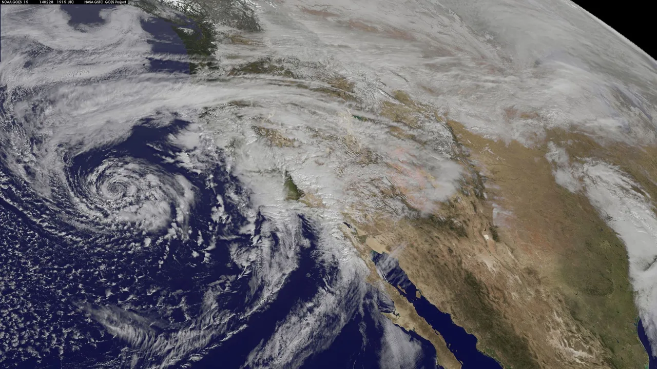
A Pacific weather system moving toward California is forecast to deliver widespread rain, possible thunderstorms and rough coastal conditions from the Central Coast down to the U.S.-Mexico border Wednesday into Thursday, forecasters said.
The incoming low-pressure system brings cooler temperatures and increasing cloud cover, with precipitation spreading over the southern Central Coast before reaching Southern California, according to the National Weather Service and local reports.
Commute disruptions and rain projections
Forecasters warned that the heaviest rainfall could disrupt drivers across Southern California, especially during Wednesday afternoon and the Thursday morning commute, Patch reported. Forecaster Zuber noted that the most intense bands could coincide directly with early morning commuters taking to the highways on Thursday.
Rain totals are projected to vary across the region, according to the weather service office covering Los Angeles and Ventura counties. Thousand Oaks could receive up to 1.73 inches of rain from Wednesday into Thursday, the Los Angeles Times reported. The weather service expects 1.53 inches in Oxnard, 1.47 inches in Santa Clarita, 1.31 inches at Los Angeles International Airport, 1.29 inches in Covina and slightly under an inch in Long Beach.
Precipitation chances will rise steeply late Wednesday. According to the weather service office in San Diego, the chance of rain surges to 95 percent Wednesday night into Thursday morning in Anaheim, Irvine and San Clemente. Similar spikes are forecast inland, with Ontario reaching a 92 percent chance, Riverside and Lake Elsinore at 91 percent, and San Bernardino at 88 percent.
Flooding concerns near wildfire burn scars
Meteorologists expressed concern over vulnerable hillsides and areas scorched by recent blazes. In Los Angeles and Ventura counties, the National Weather Service estimated a 30 to 40 percent chance of thunderstorms, accompanied by risks of widespread minor flooding and debris flows, the Los Angeles Times reported. Officials pinpointed the Santa Monica Mountains as the location facing the highest risk for flooding, specifically highlighting first-year burn scars such as those in Altadena and the Pacific Palisades.
Farther north, KSBW reported that the primary risk window for thunderstorms on the Central Coast falls on Wednesday afternoon, particularly along Big Sur and surrounding high terrain. While thunderstorm odds remain under 20 percent there, any isolated cells could trigger intense downpours and erratic winds over the Plaskett and Timber fire burn scars, raising the potential for localized flash floods and mudslides downslope.
In Orange County, emergency crews took preventative steps by spreading protective plastic coverings across vulnerable slopes in Laguna Beach, Patch reported. Laguna Beach City Manager Dave Kiff stated that Caltrans intended to place large boulders at the slope base as part of a stabilization strategy, though the full impact of the storm remains to be determined.
Dangerous surf and high tides
The system is also creating hazardous maritime conditions along the coast. Forecasters in Los Angeles and Ventura warned of breaking surf measuring between 3 and 6 feet through Thursday night on south- and southwest-facing shorelines, alongside tides reaching between 5.5 and 6.2 feet.
The weather service office in San Diego issued beach hazard advisories citing powerful rip currents and breaking waves up to 6 feet, urging beachgoers to stay out of the water to prevent accidents, the Los Angeles Times reported. Forecaster Ciliberti noted to Patch that an approaching full moon will generate elevated tides that, when paired with high surf, could produce minor to moderate coastal flooding and erosion.
Conditions are expected to ease by the end of the week. Lingering showers will continue into Thursday before the storm system shifts eastward, KSBW reported. High pressure is forecast to rebuild by Friday, bringing drier conditions and seasonal temperatures in the 60s and 70s over the weekend.