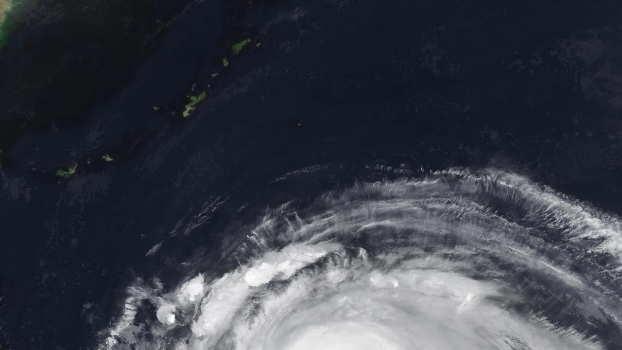
Super Typhoon Champi has intensified into the most powerful tropical cyclone on Earth this year, generating peak winds of 296 km/h (about 185 mph) as it churns across the western Pacific Ocean toward East Asia, forecasters reported.
The system is the globe’s seventh Category 5-equivalent storm in 2026, according to The Weather Network. FOX Weather reported that Champi’s sustained winds of 185 mph on Tuesday tied it with Super Typhoon Sinlaku for the strongest storm in any ocean basin this year, while The Weather Network noted its top speed surpassed Hurricane Polo’s 285 km/h mark for peak sustained wind speed.
Path toward Taiwan and Japan
Over the weekend, the storm brushed past Guam, where its eye stayed about 10 miles off the island’s southern coast. Guam Gov. Lou Leon Guerrero said the territory avoided destructive landfall and suffered minimal damage, despite gusts reaching 150 mph, FOX Weather reported.
As of Tuesday afternoon, Champi was located roughly 1,536 kilometers east-southeast of Taiwan’s southernmost point of Oluanpi, moving west-northwest at 23 km/h, according to Taiwan’s Central Weather Administration. Taiwanese forecaster Tseng Chao-cheng said authorities could issue a maritime warning Wednesday night, with a potential land warning following Thursday night depending on the cyclone’s trajectory.
Tseng noted that the probability of the typhoon curving toward the northeast has grown, but Champi is still forecast to make its closest approach to Taiwan between Friday and Saturday morning. Heavy precipitation is expected to intensify across northern and eastern Taiwan, with ocean waves off the eastern coast possibly reaching six meters on Thursday, the agency warned.
Global weather repercussions
Meteorologists say ideal environmental ingredients fueled Champi’s explosive growth. Sea surface temperatures around 30 degrees Celsius, light wind shear and rich atmospheric moisture provided ample energy, according to The Weather Network.
The storm is expected to enter a less hospitable environment and gradually weaken to a Category 3 or 4 system by Thursday or Friday as it approaches southern Japan, Okinawa and the Ryukyu Islands. However, its immense scale is already creating ripple effects in the atmosphere.
The Weather Network reported that the typhoon is interacting directly with the jet stream, influencing conditions far downstream across North America. Forecasters project the disturbance will help usher in changeable, unsettled weather across parts of eastern Canada, including Ontario and Quebec, by the middle of next week.
Meanwhile, forecasters in the eastern Pacific are monitoring another disturbance south of Mexico, designated Invest 94E, which could develop into Tropical Storm Vance within days, FOX Weather reported.