Subtropical Storm Josephine formed off the Atlantic coast on Wednesday evening, kicking up dangerous surf and strong wind gusts across portions of the Northeast before tracking farther out to sea.
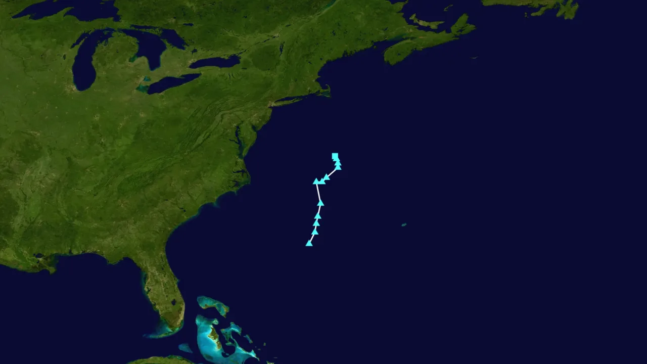
As of Wednesday night, the center of the storm was situated roughly 265 miles south of Nantucket, Massachusetts, moving northward at around 6 mph, according to advisories from the National Hurricane Center reported by Click2Houston. The storm had maximum sustained winds between 55 and 65 mph, with tropical-storm-force winds reaching outward up to 415 miles from its center.
Gusts and coastal impacts in the Northeast
Forecasters expect the storm to shift toward the northeast on Thursday while rapidly accelerating. On that projected path, the system is expected to steer away from the mainland United States, remaining well offshore and south of Nova Scotia and Newfoundland, FOX Weather reported.
Although no coastal watches or warnings were posted, local National Weather Service offices warned that gale-force gusts could brush coastal stretches through Thursday. Southeastern Massachusetts and Long Island could register wind gusts of 30 to 40 mph, with gusts potentially topping 50 mph across Nantucket and Martha’s Vineyard, according to FOX Weather. Light rain showers were also projected to clip Rhode Island and Cape Cod, though overall rainfall accumulations are forecast to stay minimal.
The system is also causing hazards along the shoreline. According to the National Hurricane Center, large swells are spreading across much of the Eastern Seaboard and sections of Atlantic Canada, generating hazardous rip currents and rough surf. Minor to locally moderate coastal flooding was recorded along portions of the Mid-Atlantic, with waters around the Chesapeake Bay expected to see lingering high water levels into Thursday or early Friday.
A rare storm in a quiet Atlantic season
Josephine represents the 10th named system of the 2026 Atlantic hurricane season, The Boston Globe reported. The storm gained subtropical characteristics as it drifted over the warm Gulf Stream while breaking away from an adjacent frontal boundary, according to FOX Weather. A subtropical system differs from a purely tropical storm primarily because its core is not completely warm, meteorologists noted.
The arrival of the storm comes during an unusually calm Atlantic season influenced by a strong El Niño pattern, The Boston Globe reported. Persistent atmospheric wind shear has suppressed storm development across the basin, leaving the region with only one hurricane so far this year—Hurricane Isaias, which did not form until Oct. 8. Experts noted that 2026 is likely to conclude with the lowest Accumulated Cyclone Energy recorded in the Atlantic basin since 1950.
What happens next
Forecasters project that Josephine will intensify slightly over open ocean waters on Thursday. The National Hurricane Center indicated the storm could briefly reach hurricane-force winds of 75 mph as it transitions into an extratropical or post-tropical cyclone, ABC7 WWSB reported.
By late Friday, the system is forecast to encounter colder waters and adverse atmospheric conditions, which will trigger a weakening trend. Within roughly four days, meteorologists expect Josephine to be fully absorbed into a broader weather pattern over the North Atlantic, while winds and surf along the U.S. coast steadily diminish heading into the weekend.