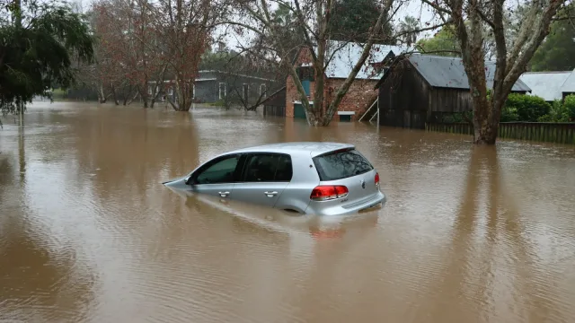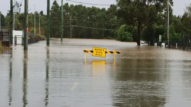
Heavy rainfall and severe flash flooding struck Central Florida on Thursday, Nov. 19, prompting mandatory evacuations, boat rescues and school closures in Brevard County, according to local officials and news reports.
The Weather Prediction Center placed Brevard County under a rare Level 4 High Risk for excessive rainfall, its highest alert category, signaling widespread and potentially catastrophic flood conditions, local television station WFTV reported.
Evacuations and Rescues in Brevard County
Rising floodwaters breached homes in parts of Brevard County on Thursday morning, prompting emergency responses across several communities. In Palm Bay, city leaders ordered mandatory evacuations for residents located in Palm Bay Estates west of the canal and east of the train tracks, WFTV reported. Police officers and firefighters utilized boats to help evacuate residents, transporting them to a temporary assembly point before relocating them to a county emergency shelter.
Brevard County emergency officials opened a public shelter at the Walter Butler Community Center in Cocoa to accommodate displaced residents. Authorities advised those arriving at the facility to bring their own bedding, medications, clothing, hygiene products and personal supplies.
Water intrusion was also reported in residential neighborhoods near Anderson Elementary School in Rockledge, while street flooding spread across Port St. John. In Titusville, the mayor issued a local state of emergency as heavy rain bands moved through the region. Early Thursday morning, coastal locations including Sharps, Cocoa and Cocoa Beach had already recorded more than 6 inches of rainfall, according to WFTV.
Radar estimates indicated that central Brevard County received between 7 and 11 inches of rain during the storm, with additional precipitation falling into the afternoon. A flood warning remained active for southeastern Brevard County through 6 p.m., covering municipalities including Melbourne, West Melbourne, Malabar, Indialantic, Melbourne Beach, Grant-Valkaria, Barefoot Bay and Micco.
River Levels and Regional Impact
Beyond surface runoff, rising river levels have created long-term flood hazards across Central Florida. Channel 9 Chief Meteorologist Tom Terry reported that the St. Johns River near Cocoa reached a record height of 18.3 feet on Thursday. Forecasts indicate the river could rise further to 18.6 feet on Friday, maintaining a major flood stage that will prolong inundation in nearby neighborhoods and over roadways.
Terry noted that the surge along the St. Johns River will push elevated water downstream toward Lake Harney, Sanford, DeLand and Astor over the weekend. Meanwhile, rainfall across Metro Orlando was forecast to reach between 4 and 8 inches, while other inland areas were expected to pick up 2 to 6 inches. Coastal areas could accumulate 8 to 14 inches, with some localized coastal zones exceeding 14 inches, according to WFTV.
The severe weather caused widespread disruptions to public education. Brevard Public Schools announced that all district campuses and offices would remain closed on Friday, Nov. 20. With schools already scheduled for Thanksgiving break the following week, students and staff are expected to return on Monday, Nov. 30. Volusia County Schools also closed all campuses and canceled extracurricular events for both Thursday and Friday.
What Happens Next
Forecasters expect flood risks to persist as an additional 3 to 5 inches of rain remains possible through early Saturday, WFTV reported. A coastal weather system is anticipated to develop to the southeast on Friday before moving north on Saturday, with the potential to develop into a subtropical or tropical storm.
Local authorities urged residents in flood-prone areas to monitor official updates, avoid driving through water-covered roads, and prepare for potential power outages or further evacuation orders. Weather forecasts project that the storm system will exit the region by Sunday, bringing a return to drier conditions.