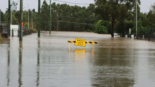
A series of Pacific storms driven by an atmospheric river pounded California on Wednesday, Nov. 18, bringing heavy rain, mountain snow, and high winds across the state. The widespread weather system created severe travel disruptions along major highway corridors, knocked out power to thousands of residents, and triggered flood watches in coastal areas and wildfire burn scars.
Heavy Mountain Snow Causes Severe Travel Delays
National Weather Service forecasters warned that the Sierra Nevada could receive between two and four feet of snow above 5,000 feet through Friday morning, with up to five feet accumulating on the highest peaks, CBS News reported. Wind gusts across Sierra ridgetops were projected to reach up to 100 mph, according to The Weather Channel.
The heavy snowfall rapidly created hazardous travel conditions across critical mountain passes. Westbound traffic on Interstate 80 was temporarily held near Truckee on Wednesday morning because of vehicle spinouts, CBS News reported. State officials instituted mandatory chain controls along Interstate 80, Highway 50, and portions of Highways 88 and 89 surrounding Lake Tahoe.
In Northern California, snow levels dropped to approximately 3,500 feet in Siskiyou County, Yahoo reported. State transportation officials screened northbound motorists on Interstate 5 at Fawndale, north of Redding, requiring vehicle chains or snow tires before drivers could proceed toward Dunsmuir and Weed. Chain requirements were also enacted on Highways 44 and 299.
High Winds and Flood Warnings at Lower Elevations
In lower elevations, strong winds and heavy rainfall produced additional hazards. The Sacramento Valley, Delta, and surrounding foothills were placed under a wind advisory, with winds reaching 20 to 30 mph and gusts climbing as high as 55 mph, according to CBS News. The high winds initially knocked out power to more than 32,000 customers in the Sacramento area early Wednesday morning, though the Sacramento Municipal Utility District reported that active outages fell to 555 customers by mid-morning.
To help residents prepare for potential street flooding, Sacramento County officials opened three sandbag distribution sites in unincorporated areas, including Branch Center, the Orangevale Community Center, and Sacramento Metropolitan Fire Station 116, CBS News reported.
Coastal areas were expected to receive three to six inches of rain, while foothill regions were projected to get over six inches, according to The Weather Channel. The National Weather Service issued flood advisories for much of the San Francisco Bay Area and warned of coastal flooding, beach erosion, and high surf in Southern California. Areas recovering from recent wildfires, including burn scars in Big Sur and the Napa Valley, faced heightened risks of flash flooding and debris flows, The Guardian reported.
Southern California Impacts and Early Ski Openings
In Southern California, forecasters predicted one to three inches of rain in lower elevations and three to five inches in mountain and foothill zones, alongside a 20 percent chance of thunderstorms on Wednesday and Thursday, according to The Guardian. Weather officials warned of a moderate risk for rockslides and mudslides.
Despite the travel chaos, the early-season snowpack provided a significant boost to local ski resorts. CBS News reported that resorts such as Palisades Tahoe and Sugar Bowl accelerated their opening dates to this week, joining Heavenly and Northstar in welcoming winter sports visitors.
National Weather Service meteorologists indicated that skies are expected to clear in parts of Northern California by Thursday night. However, additional storm activity and seasonal high tides are anticipated during Thanksgiving week, presenting potential ongoing flood risks, news reports said.