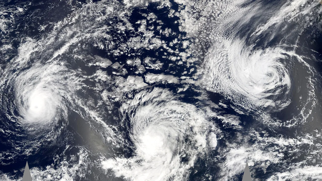
Hurricane Trudy intensified into a Category 2 storm on Saturday as it pushed toward Mexico’s southwestern and west-central Pacific coast, triggering emergency advisories and warnings of life-threatening flash floods, according to the U.S. National Hurricane Center.
At the same time, thousands of miles away in the western Pacific, Typhoon Champi rapidly intensified into a dangerous Category 4 system while hurtling toward Guam and the Northern Mariana Islands, prompting widespread closures and urgent pleas for federal disaster aid.
Trudy tracks along the Mexican shoreline
The National Hurricane Center reported that Trudy generated sustained wind speeds reaching 100 mph on Saturday. A hurricane warning remained active along a stretch of coast stretching from Manzanillo in Colima state to Cabo Corrientes in Jalisco. By late Saturday, the system was tracking northwest at approximately 10 mph, centered about 115 miles south-southwest of Manzanillo and 205 miles south-southeast of Cabo Corrientes.
Mexican authorities posted a tropical storm warning for Las Islas Marias while dropping watches and warnings south of Lazaro Cardenas. Trudy was forecast to pass near the coast through Sunday before gradually weakening.
Meteorologists cautioned that Trudy could dump between four and eight inches of rainfall across Jalisco, Colima and Michoacan through the weekend, with isolated pockets receiving up to 15 inches. Outer bands were also projected to produce two to four inches of rain across Nayarit and Guerrero.
The Mexican navy instructed mariners and coastal communities to take extreme precautions against high seas, storm surge and rapidly rising rivers. Officials in Colima noted that while baseline danger levels were moderate, previous storms had left local terrain heavily waterlogged, drastically amplifying the danger of severe mudslides and inundation.
Typhoon Champi approaches Guam
In the western Pacific, Typhoon Champi posed an immediate threat to American territories. The National Weather Service stated the system grew into a Category 4 storm, traveling west at 15 mph. Reports on wind speeds varied slightly, with the National Weather Service noting sustained winds of 140 mph Saturday night, while some tracking updates reported winds reaching 150 mph.
Champi was projected to pass just south of Guam early Sunday local time while gathering further strength, forecasters warned. Typhoon warnings were posted for Guam and Rota, while Saipan and Tinian were placed under a tropical storm warning and typhoon watch.
Anticipating severe damage, the governors of Guam and the Northern Mariana Islands submitted requests on Friday for federal emergency disaster declarations. If approved by President Donald Trump, the measures would clear the way for direct federal funding and emergency assistance.
Island officials halted operations at local seaports, airports and selected medical clinics. The Federal Emergency Management Agency noted Saturday that emergency relief shipments would likely take between three and five days to reach the remote Pacific islands. Both territories are continuing recovery operations following Super Typhoons Sinlaku and Bavi, which struck the region in April and July.
Weather agencies in both hemispheres plan to maintain close monitoring of the twin storms as they deliver heavy surf, high winds and localized flooding through Sunday.