National Weather Service meteorologists issued tornado warnings across northern and central Arizona on Wednesday morning as an uncommonly potent autumn storm brought hail, torrential rainfall and rotating thunderstorms to the desert Southwest.
Emergency alerts sounded across Yavapai and Coconino counties after radar detected rotation in severe thunderstorm cells near Prescott Valley and areas north of Cottonwood, according to reports from Yahoo and Signals AZ. The weather service warned that the fast-moving cells could unleash damaging wind gusts, hazardous flying debris and hail ranging from quarter-sized to egg-sized.
Unusual October Hazard Levels
Forecasters placed communities such as Flagstaff and Prescott under a Level 3 out of five risk for severe thunderstorms, FOX Weather reported. The network noted that central Arizona has not faced a Level 3 severe weather threat in October since the National Oceanic and Atmospheric Administration implemented its five-tiered convective outlook scale in 2015.
Severe weather in Arizona typically concentrates within the summer monsoon window that runs from mid-June through September. On average, the state experiences between four and six tornadoes each year, but twisters in the region are generally brief and weak, Yahoo reported based on weather service data.
A Level 2 risk covered the Phoenix metropolitan area on Wednesday, including Scottsdale, Glendale and Chandler, where secondary rounds of severe storms were expected to intensify through the evening hours.
Flooding Threats Spread Across the West
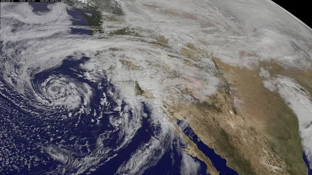
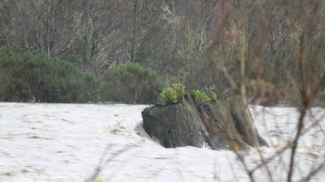
The severe weather was not confined to Arizona. A broad disturbance pulling moisture inland triggered flood watches stretching across Southern California, southern Utah, southwestern Colorado and western New Mexico, according to reports from FOX Weather and the Daily Mail.
In Southern California, heavy rain prompted flood advisories from Santa Barbara southward to Los Angeles, with forecasters warning that drenching downpours could trigger flash floods over vulnerable wildfire burn scars, FOX Weather reported. Meteorologists also noted a slight risk of waterspouts or isolated, brief tornadoes forming along the coastal corridor.
According to AccuWeather meteorologists cited by the Daily Mail, the storm complex is drawing strength from an upper-level Pacific low combining with tropical moisture from the remnants of Hurricane Trudy off Mexico’s coast. Strong atmospheric wind shear has heightened the potential for supercells capable of generating gusts comparable to a Category 1 hurricane, with localized winds possibly reaching 70 to 80 mph in some mountain and desert corridors.
The FOX Forecast Center also reported that the intense southern storm track could preview an active winter across the southern tier of the United States driven by an anticipated Super El Niño pattern.
Safety Precautions and Next Steps
Officials urged residents across the affected states to monitor changing conditions closely as thunderstorms shift eastward toward the Rocky Mountains on Thursday.
Weather service officials advised that if a tornado warning is declared, individuals should immediately abandon vehicles and mobile homes to take shelter in an interior room on the lowest floor of a sturdy building, keeping as many walls as possible between themselves and the exterior. Drivers caught near rising waters were warned never to cross flooded roadways, as the majority of flash flood fatalities occur inside vehicles.