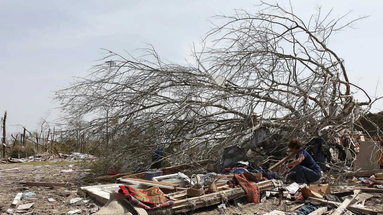
RALEIGH, N.C. — Emergency crews and residents across central North Carolina worked Monday to clear debris and inspect widespread destruction after a severe weather system spawned at least five tornadoes, peeling roofs from homes, flipping cars and cutting electricity across several counties on Sunday.
The turbulent weather moved across the state throughout Sunday afternoon as part of the remnants of Isaias, WRAL reported. Forecasters with the National Weather Service in Raleigh indicated they were reasonably confident that nearly half a dozen tornadoes touched down, with three to six additional potential touchdowns still under review.
Severe damage in Raleigh and Fayetteville
Wake and Cumberland counties experienced some of the most intense impacts from the storms, with damage reported in neighborhoods and commercial corridors alike. WRAL reported that several dozen buildings were damaged or destroyed across the region, though emergency officials confirmed no serious injuries had been reported as of Sunday night.
In northeast Raleigh, residential areas near the Neuse River, including the 5401 North and Neuse Crossing subdivisions, sustained heavy property destruction. High winds peeled off sections of roofs and hurled airborne debris through neighborhood streets.
Resident Will Johnson told WRAL that the storm passed in roughly a minute, leaving fences flattened and trampolines flung into yards. Another resident, Erik Grubbs, told reporters from ABC11 and WRAL that emergency phone alerts allowed him to rush into an interior bathroom with his dog just moments before a window blew inward and portions of his home’s roof caved in.
To the south in Fayetteville, the first confirmed tornado struck around 12:05 p.m. in the Yadkin Acres area, WRAL reported. High winds shifted and flipped parked cars outside a Sam’s Club, and a section of roof was torn from a neighboring Marriott hotel. Fayetteville Fire Chief Kevin Dove told ABC11 that five commercial buildings on Skibo Road suffered structural damage, while dislodged HVAC machinery prompted the temporary evacuation of a Walmart.
Trail of damage spans multiple counties
Radar records indicated confirmed tornadoes also struck near Jordan Lake west of Apex, crossed the Wake-Johnston county line near Clayton, and touched down close to Louisburg, WRAL reported.
In Clayton, fallen timber blocked railroad tracks near Clayton Boulevard and N.C. 42 East before utility crews managed to clear the rails by Sunday evening, according to ABC11. Town officials noted that traffic signals went dark and multiple utility poles sustained damage, briefly interrupting rail traffic and cutting power.
Outlying counties felt significant impacts as well:
- In Harnett County, Deputy Fire Marshal Brian Heath reported structural damage to multiple residences along Highway 401 and Josey Williams Road, ABC11 reported.
- Chatham County dispatchers confirmed a touchdown roughly nine miles east of Pittsboro.
- Farther west, overnight flash flooding and mountain landslides forced emergency crews to perform multiple water rescues, according to state emergency management officials.
- Duke Energy recorded approximately 2,000 electricity interruptions across the region Sunday, concentrated mostly in Cumberland and Vance counties, according to WRAL.
What happens next
State emergency management officials said response personnel are shifting from immediate rescue efforts to comprehensive assessments while coordinating with federal authorities on potential community aid. Three National Weather Service survey teams are scheduled to deploy Monday to inspect suspected touchdown paths and determine official storm ratings.