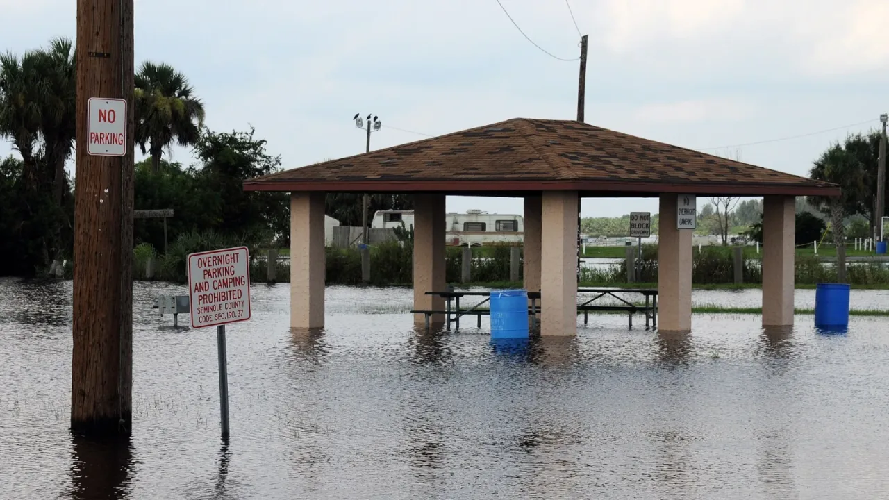
As heavy rainfall finally eases across eastern Florida, emergency officials warned Saturday that cresting rivers will cause historic flooding to persist for days or weeks, while the expansive storm system moves north to disrupt Thanksgiving holiday travel along the East Coast.
The slow-draining St. Johns River basin has become the epicenter of a lingering crisis in central Florida following days of relentless precipitation. West of Cocoa, the river climbed past its previous record high to reach 17.2 feet, inundating homes around Lake Poinsett, Shakespeare Park, and the Silver Pines subdivision. The gauge registered another 1.5 feet higher on Friday, with forecasters expecting water levels to remain near 18.8 feet through the weekend and into early next week.
Emergency managers warned that standing water continues to cut off access to entire neighborhoods, making roads like Providence Road west of Cocoa impassable and leaving homes isolated near Mullet Lane and Bass Road.
Historic river levels across central Florida
“This is just an incredible amount of water that will cause the river to continue to rise for the next several days,” Will Ulrich, a warning coordination meteorologist in Melbourne, told the Associated Press.
River gauge monitoring points across Brevard, Volusia, Lake, Seminole, and Clay counties are either in major flood stage or projected to reach it soon. Farther inland near Geneva, the St. Johns River above Lake Harney reached 11.7 feet on Friday night—nearly double its six-foot bankfull level—and was forecast to crest near 13 feet late this weekend.
Downstream communities face prolonged inundation as runoff flows northward. Minor flooding in Sanford is expected to escalate to major flood stage by midweek, threatening low-lying structures around Lake Monroe. Near DeLand, levels are rising toward major flood stage near Hontoon Island, while residents in Astor face water entering homes along canals that could take weeks or months to recede.
Rescues, evacuations, and emergency response
The historic flooding follows an unrelenting weather pattern that dumped more than two feet of rain on Cocoa Beach and nearly 17 inches on Daytona Beach since Monday—surpassing normal autumn rainfall totals for the region. November has already become the wettest on record for Melbourne, Daytona Beach, West Palm Beach, and Fort Lauderdale, FOX Weather reported.
In response to widespread devastation, Florida Gov. Ron DeSantis activated the National Guard on Thursday and deployed more than 1,000 state workers. Emergency response crews have executed nearly 200 water rescues, set up 9,000 feet of flood barriers, distributed 20,000 sandbags, and brought in heavy machinery to repair damaged highways such as Interstate 95.
Local authorities carried out rescues across multiple counties. In Palm Bay, Fire Chief Richard Stover told CNN that a washed-out bridge cut off access to Palm Bay Estates, leading to mandatory boat evacuations for 65 mobile homes. In Volusia County, local officials reported approximately 20 rescues and about 100 flooded homes in Edgewater. Earlier in the week, Florida Fish and Wildlife Conservation Commission officers helped rescue more than 90 residents from a flooded apartment complex in Broward County, as well as an infant who stopped breathing in a vehicle trapped by floodwaters.
Storm system moves north toward New England
Although rainfall over saturated Florida communities decreased on Saturday, the broader storm system shifted northward. On Saturday morning, strong winds with gusts ranging from 20 mph to 40 mph and rain lashed coastal Georgia and South Carolina, with precipitation expected to spread into North Carolina by late afternoon, CNN reported.
Forecasters expect the storm to accelerate overnight into Sunday, bringing heavy rain and gusty winds to the Mid-Atlantic corridor, including Washington, D.C., Philadelphia, and New York City. By late Sunday afternoon, rain is forecast to spread into New England cities such as Boston, Hartford, and Providence. The National Weather Service warned that ponding water on major roadways, including Interstate 95, alongside gusty coastal winds, could cause widespread flight delays and travel slowdowns ahead of the Thanksgiving holiday.